Catalog Archive
Auction 170, Lot 266

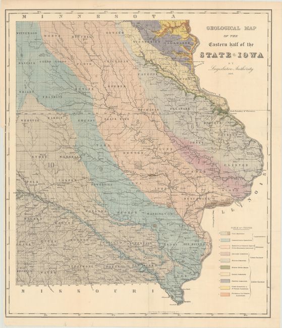
"Geological Map of the Eastern Half of the State of Iowa by Legislative Authority", Hall, James

Subject: Iowa, Geology

Period: 1857 (dated)

Publication: Report of the Geological Survey of the State of Iowa

Color: Hand Color

Size:
19.9 x 23.1 inches
50.5 x 58.7 cm
Download High Resolution Image
(or just click on image to launch the Zoom viewer)

This attractive geological map of the eastern portion of the state was issued in "Report of the Geological Survey of the State of Iowa" by James Hall, J.D. Whitney, and A.H. Worthen. The map is color-coded to present 10 different geological structures including coal, limestone, sandstone and shale. The underlying base map reveals additional details including the expanding railroad network, wagon roads, cities and towns, and county boundaries. Lithographed by Sarony, Major & Knapp in New York.

References: Marcou & Marcou #455.

Condition: B+

Issued folding with a 7" binding tear at left that has been closed on verso with archival tape. There are several tiny splits at fold intersections with minute loss near Grundy County.

Estimate: $100 - $130

Sold for: $80

Closed on 11/14/2018

Archived