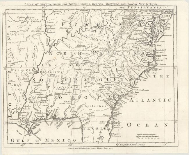
Subject: Colonial Southeast United States
Period: 1755 (dated)
Publication: London Magazine
Color: Black & White
Size:
10.3 x 8.4 inches
26.2 x 21.3 cm
This uncommon little map of the Southeast was based upon John Mitchell's Map of the British Colonies. The colonies are shown to extend to the Mississippi River, beyond which is French Louisiana and the domains of the Arkansas, Chactaw, and Osage Indians. There is no border shown between South Carolina and Georgia and most of that region is dominated by Indians villages and a lone Eng. Factories in present-day Mississippi. Many early forts are located including Ft. Mobile, Ft. Rosalie, Ft. Francis, Ft. Chartres, Ft. Orleans on the Missouri, and numerous unnamed French and English forts.
References: Jolly #LOND-95; Cumming (SE) #294; Sellers & Van Ee #1381.
Condition: A
A crisp impression issued folding on a clean, bright sheet with a single tiny rust spot and a narrow left margin.