Subject: World
Period: 1652 (dated)
Publication:
Color: Hand Color
Size:
20.9 x 13.9 inches
53.1 x 35.3 cm
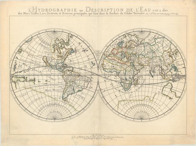
This uncommon double hemisphere world map exemplifies the more austere style of Nicolas Sanson, often referred to as the 'the father of French cartography.' Whereas the Dutch cartographers are known for their fabulous decorations and coloring, the French cartographers, led by Sanson, are known for pioneering the scientific method of cartography. The map is similar to Sanson's 1651 edition (Shirley #390), but with more prominence given to marine and river features. California is shown as an island. On this map, Sanson has renamed Nouvelle Albion in the northwest part of North America as Terra de Iesso, and the Detriot d'Anian has been moved to just north of California. It is one of the first maps to distinguish the Great Lakes. Australia is only partially shown, still marked Beach, and there is a faint outline of the southern continent labeled Terre Australe Magellanique et Incogneue.
References: Shirley #394; Wagner #367.
Condition: B+
A crisp impression on a watermarked sheet with several tears around the centerfold at bottom that have been closed on verso with archival materials, with some associated cockling of the paper in the same area. There are chips in the bottom corners of the sheet that have been professionally repaired with old paper.