Catalog Archive
Auction 169, Lot 93

"Carte Contenant le Royaume du Mexique et la Floride, Dressez sur les Meilleures Observations & sur les Memoires les Plus Nouveaux", Chatelain, Henry Abraham

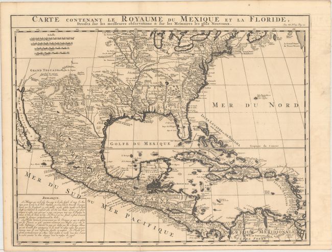
Subject: Colonial North America & West Indies

Period: 1719 (circa)

Publication: Atlas Historique...

Color: Black & White

Size:
20.4 x 15.9 inches
51.8 x 40.4 cm
Download High Resolution Image
(or just click on image to launch the Zoom viewer)

This is a derivative of Delisle's landmark map of the southern part of North America and the West Indies. The detailed map shows many English settlements along the East Coast and carefully notes the discoveries of D'Iberville along the Gulf Coast and Mississippi River. The vast region, later known as Louisiana, from Florida through present-day Texas is shown as the French possession of Floride. There is also a great amount of detail in Nouveau Mexique, particularly of the Spanish missions: Santa Fe, Taos, and Acoma.

References: Martin & Martin, p. 93.

Condition: B+

Issued folding on watermarked paper with a centerfold separation at bottom that extends 2" into the image that has been closed on verso with archival material. Faint offsetting.

Estimate: $750 - $900

Sold for: $450

Closed on 9/12/2018

Archived