Subject: Africa
Period: 1766 (dated)
Publication:
Color: Hand Color
Size:
12.3 x 11 inches
31.2 x 27.9 cm
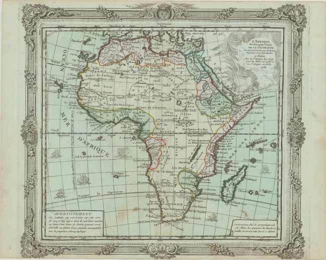
This handsome continental map is decorated with a pictorial title cartouche and several ships under full sail. The interior of the map contains little geographical information, as is typical of the period. Large rivers are evident, but the larger lakes are not marked. The Nile flows from two small lakes, located in the Mts. de la Lune above the equator. In the south there is a minimum of place names and a few tribal names. Brion was the former Geographer to the King of France, and Desnos was Geographer to the King of Denmark. This edition is exactly the same map as described by Norwich, just with a variation on the highly decorative border and no surrounding text. A separate plate was used to print the border.
References: Norwich #97.
Condition: B+
Original color on bluish watermarked paper with a 2" centerfold separation at top and some light staining along the bottom.