Subject: Southern Asia, Arabia & Eastern Africa
Period: 1680 (circa)
Publication:
Color: Hand Color
Size:
18.3 x 15.4 inches
46.5 x 39.1 cm
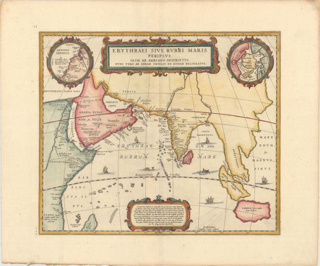
Jansson based this map on Ortelius' historical map of the same title, which was in turn based on the account of Arian, the Roman governor of Cappadocia (AD 134). Arian's description of Asia included the accounts of Alexander the Great among his sources. This classical map covers from Egypt to Indonesia as far as Java. In the upper right is an inset of the north pole (Hyperborei) included by Ortelius to remind his readers that despite recent attempts, a passage to the Far East via the North Pole had not yet been found. To balance the composition, an inset of Annonis Periplus occupies the upper left corner. This small inset represents the Northwest coast of Africa showing part of the explorations of the ancient King Hanno from Carthogo, who legend says was the first to sail around the continent of Africa to reach the Arabian Sea. The map is richly engraved with two cartouches, strapwork engraving around the insets and an array of monsters and sailing ships. Blank verso.
References: Van der Krogt (Vol. I) #0500H:1.
Condition: A
A nice impression with wide margins, some printer's ink residue at bottom right, and light toning along the edges of the sheet.