Subject: Western India
Period: 1672 (published)
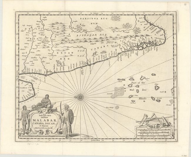
Publication: Naauwkeurige Beschryvinge van Malabar en Choromandel…
Color: Black & White
Size:
14.2 x 11.4 inches
36.1 x 29 cm
This uncommon map was created by Philip Baldaeus, a Dutch missionary in the Malabar and Coromandel districts. His work, Naauwkeurige Beschryvinge van Malabar en Choromandel…, is considered one of the foremost sources regarding Dutch settlements in southern India. The map depicts western India from the southern tip up to Surat, including a portion of the Kathiawar peninsula. Numerous small towns are noted along the coastline and along the rivers, including Mumbai (Bombaia), Goa, Calicut, Cochin (Cotchyn), and Quilon (Coulan). The coastal area is divided into several regions: Malabar, Canara (Kanara) and Decan (Deccan). The map is embellished with a compass rose, a distance scale topped with measuring dividers and maps, and a decorative title cartouche flanked by three natives.
References: Shirley (BL Atlases) G.BALD-1a #1.
Condition: A
A dark impression on a clean sheet. Issued folding.