Subject: Eastern China
Period: 1693 (circa)
Publication: Corso Geografico Universale
Color: Hand Color
Size:
24.2 x 17.9 inches
61.5 x 45.5 cm
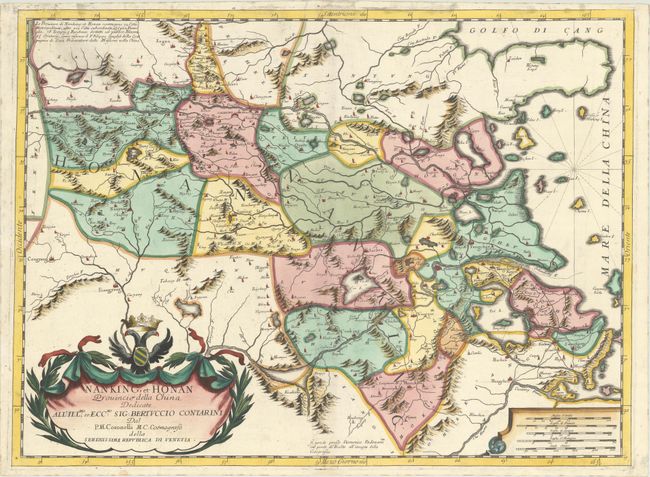
This splendid map of Nanking and Honan (comprising the present-day provinces of Henan, Anhui, and Jiangsu) comes from a set of six maps showing thirteen Chinese provinces. The map was based on the Blaeu/Martini map, but was rendered in Coronelli's unique, flourishing style with mountains, forests, lakes, rivers and towns all graphically depicted and embellished with large title and scale cartouches. The Jesuit missions are noted on the map with "IHS," including the cities of Suzhou and Songjiang. Vincenzo Coronelli was a Franciscan priest and renowned mathematician and cartographer. He was appointed official Cosmographer to the Venetian Republic in 1685 and founded the world's earliest geographic society, L'Accademia Cosmografica degli Argonauti.
References:
Condition: A
A dark, crisp impression on a clean, bright sheet with an archivally repaired edge tear that just enters the map border at top. There is minor soiling in the blank margins, entering the map border a bit at top.