Subject: Kamchatka Peninsula
Period: 1785 (circa)
Publication: Atlas du Troisieme Voyage de Cook
Color: Black & White
Captain James Cook (1728-1779) is best known for his three voyages to the Pacific (1768-71; 1772-75; and 1776-79). His discoveries radically changed the western understanding of the world in the late 18th century. He was the first to circumnavigate and chart New Zealand and provided the earliest European accounts of exploration along the eastern coast of Australia and the Hawaiian Islands. On February 14th, 1779, he was killed on Hawaii after attempting to kidnap the chief of the island.
Many contemporary accounts of Cook’s voyages, including charts and engravings, appeared in the late 18th century. The first official account of Cook’s first voyage was published in 1773 by John Hawkesworth in Volumes II and III of An Account of the Voyages Undertaken by the Order of His Present Majesty for Making Discoveries in the Southern Hemisphere... William Strahan and Thomas Cadell published the first official accounts of the second and third voyages in 1777 and 1784. Accounts of his exploration were subsequently translated into French, German, and Dutch.
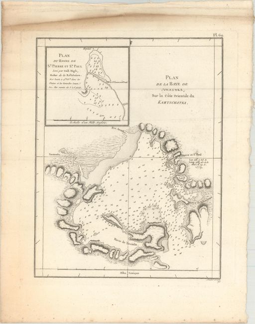
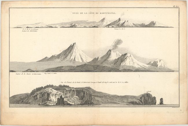
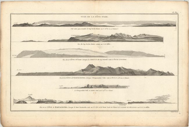
This lot features a chart and two sheets of views focusing on the Kamchatka Peninsula region. The chart shows Avacha Bay with fine topographical detail along the coast and soundings in the water. An inset at top left zooms in on the harbor at present-day Petropavlovsk-Kamchatsky. The views depict Kamchatka's mountainous coast. Engraved by Benard.
A. Plan de la Baye de Awatska, sur la Cote Orientale du Kamtschatka, (7.8 x 10.1").
B. Vues de la Cote du Kamtchatka, circa 1785 (15.1 x 8.9").
C. Vues de la Cote d'Asie, circa 1785 (15.1 x 8.7").
References: Shirley (BL Atlases) G.COOK-4a #17.
Condition: B+
All three sheets are crisp impressions with light soiling. The chart is on watermarked paper. There are some minor spots on the views.