Subject: Northern Asia
Period: 1706 (dated)
Publication:
Color: Hand Color
Size:
25 x 19 inches
63.5 x 48.3 cm
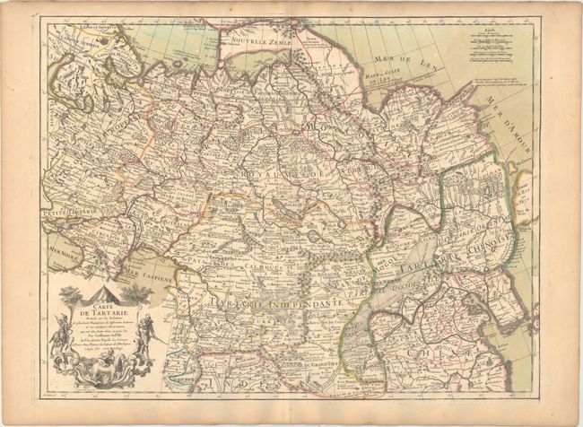
This is the first edition of Delisle's expansive map that spans from Novaya Zemlya in the north to Afghanistan and includes Russia, Northern China, and Tibet. The Pacific coast shows a portion of the Terre d'Eso, with the small Isle de Amour shown above. The map is fully engraved with forests and mountains, and it features quite good detail of cities and towns for the period. The Great Wall is graphically depicted, as are the extensive trade routes. A decorative cartouche surrounds the title in the lower left. This edition carries Delisle's imprint "A Paris Chez l'Auteur sur la Quai de l'Horloge a l'Aigle dOr avec Privilege 1706." The map was engraved by des Rosiers and the cartouche was engraved by N. Guerard.
References:
Condition: A
A nice impression on watermarked paper with original wash and outline color. There is an archivally repaired centerfold separation confined to the bottom blank margin and light toning along the edges of the sheet.