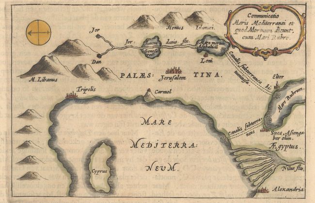
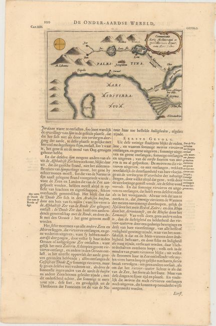
Subject: Eastern Mediterranean
Period: 1682 (published)
Publication: D'Onder-Aardse Weereld
Color: Hand Color
Size:
6.1 x 4 inches
15.5 x 10.2 cm
This interesting little map covers the eastern part of the Mediterranean, the Middle East and the Nile Delta. It depicts the Red Sea, Dead Sea and Sea of Galilee with underground canals connecting them with the Mediterranean. This is from Kircher's masterpiece, an immense and amazing work covering all aspects of anything that dwelled or occurred within the earth's interior - from dragons, to fossils, to mountain springs, earthquakes, and volcanoes. Kircher's work was the first serious effort to describe the physical makeup of the earth, proposing theories (sometimes fantastic) in the areas of physics, geography, geology, and chemistry. He suggested the existence of a vast network of underground springs and reservoirs, as well as the theory that subterranean temperatures increase directly in proportion to depth. Published in a Dutch edition of Kircher's famous Subterranean World. On a full sheet of Dutch text measuring 9.6 x 14.6".
References:
Condition: A
Some very faint stains outside of the map image.