Subject: Eastern Mediterranean
Period: 1650 (published)
Publication: Atlantis Majoris Quinta Pars Orbem Maritimum seu...
Color: Hand Color
Size:
21.4 x 16.4 inches
54.4 x 41.7 cm
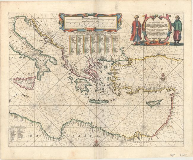
An attractive and uncommon chart of the eastern Mediterranean extending from Italy and Malta east to Candia, Cyprus, Syria, and the Holy Land. The coastlines are absolutely packed with place names, and a numbered key identifies over 100 islands. Decorated by strapwork distance and title cartouches at top, two compass roses, and rhumb lines. Title is written in both Latin and Dutch. Latin text on verso with page numbers 229-230, indicating it was published in the first edition of 1650.
This chart was issued in Jansson's Atlantis Majoris Quinta Pars Orbem Maritimum seu..., considered to be the first true sea atlas. Pilot guides supplemented with charts appeared as early as 1584, but not as a collection and issued in folio size prior to 1650. The Atlantis Majoris served as the fifth volume of Jansson's Atlas Novus.
References: Van der Krogt (Vol. 1) #0302:1A.
Condition: B+
A nice impression with light scattered foxing and faint show-through from text on verso.