Subject: Balearic Islands
Period: 1770 (circa)
Publication:
Color: Hand Color
Size:
22.2 x 19.1 inches
56.4 x 48.5 cm
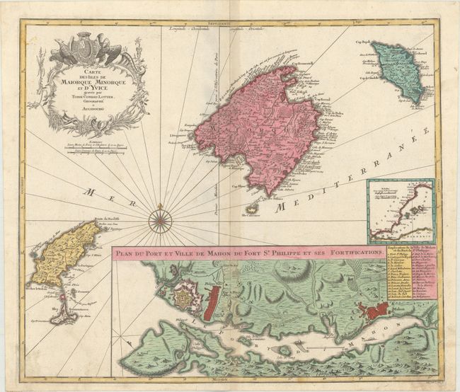
This fine copper engraved map of the Spanish Balearic Islands is based on Bellin, and is a later state of Matthais Seutter's map, originally published in 1741. Lotter made significant changes to the bottom half of the plate, extending the map 3" to the south in order to increase the size of the inset of Mahon, and eliminating the block of text Seutter had included below the map. The inset of the port and city of Mahon on the island of Menorca now dominates the map, giving excellent detail of the fortifications, roads, and important locations, which are identified in a numbered key. Lotter also re-engraved Seutter's inset showing the location of the Balearic islands in relation to Spain and the Mediterranean, although this time on a smaller scale. The decorative title cartouche and compass rose remained the same, with small modifications to the title. A very handsome chart with good detail of the towns, roads, and topography on each of the islands.
References:
Condition: B+
Striking contemporary color on paper with an anchor watermark, light toning along the centerfold, and some soiling in the bottom corners of the map.