Subject: South Pole
Period: 1714 (dated)
Publication:
Color: Hand Color
Size:
17.8 x 17.9 inches
45.2 x 45.5 cm
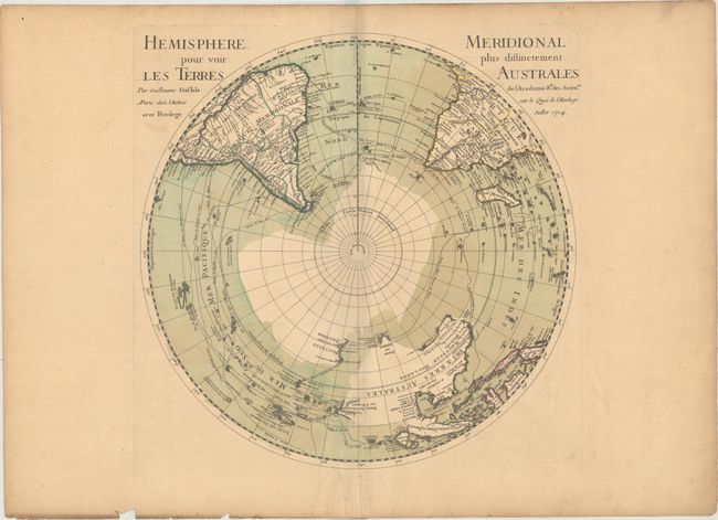
Delisle's map depicting the Southern Hemisphere shows the tracks of the explorers and circumnavigators around the southern oceans including Magellan in 1520, Abel Tasman in 1642, and Edmund Halley in 1698-1700. The map provides very good detail, particularly of the explorations and discoveries in the South Pacific. Australia, New Guinea, Tasmania, and New Zealand are partially delineated, with Australia and New Guinea nearly attached to one another.
References: Tooley (Australia) p. xxxi, #42.
Condition: B+
A nice impression on watermarked paper with original wash and outline color. There is some extraneous creasing along the centerfold, minor offsetting, and light toning along the edges of the sheet.