Catalog Archive
Auction 169, Lot 518

"Le Detroit, de Gilbraltar, par Lequel, l'Ocean, Entre dans la Mer, Mediterrannee, et qui Separe, l'Europe, de l'Afrique... [on sheet with] Cadis, Vile Considerable, Fameux Port sur l'Ocean...", Fer, Nicolas de

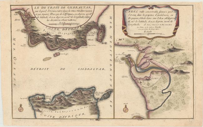
Subject: Strait of Gibraltar & Cadiz, Spain

Period: 1705 (dated)

Publication: Les Forces de l'Europe

Color: Hand Color

Size:
13.1 x 8.3 inches
33.3 x 21.1 cm
Download High Resolution Image
(or just click on image to launch the Zoom viewer)

Nicolas de Fer held the title of geographer at Louis XIV's court. He was one of the most prolific publishers of plans of European cities in the late seventeenth century. The fortifications plans in Les Forces de l'Europe were designed to teach fortification techniques. Engraved by Van Loon and Schoonebeek after French engineers under the command of Vauban, the renowned military architect. The illustrations often include a description and a legend with the principal buildings; each city plan includes both fortifications and street layout.

This sheet includes a map of the Strait of Gibraltar and a close-up map of the city of Cadiz, Spain. Cities are depicted in miniature and anchorages are marked.

References: Pastoureau, FER IX C.

Condition: A

A nice impression with very light printer's ink residue and remargined at left with period-correct paper.

Estimate: $200 - $230

Sold for: $150

Closed on 9/12/2018

Archived