Catalog Archive
Auction 169, Lot 501

"Carte Generale d'Espagne en Archeuesches ou Evesches Comme ils sont a Present", Sanson/Mariette

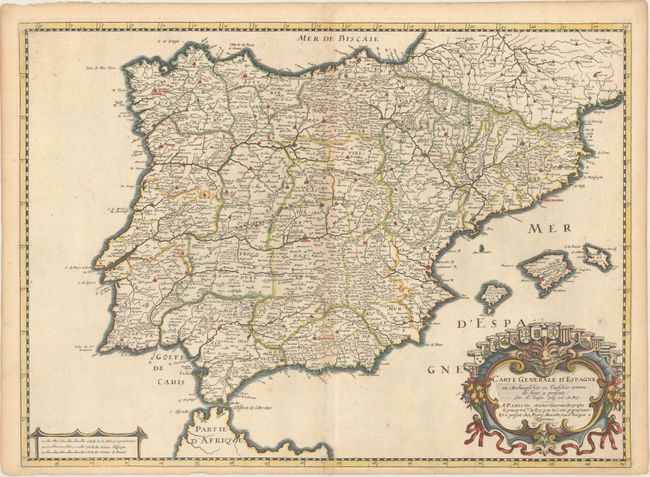
Subject: Spain & Portugal

Period: 1641 (dated)

Publication:

Color: Hand Color

Size:
21.9 x 16 inches
55.6 x 40.6 cm
Download High Resolution Image
(or just click on image to launch the Zoom viewer)

This decorative map of the Iberian peninsula brings together three important names that were involved in the Parisian map publishing trade in the seventeenth century. It was drawn by Nicolas Sanson, Geographe Ordinaire du Roi, engraved by Melchior Tavernier, and published in conjunction with Pierre Mariette. (Read our article on the complicated relationship between Sanson and Mariette here.) The map includes the Balearic Islands and is decorative with a fine cartouche featuring the heralds of the various regions.

This example is particularly interesting as it includes an engraved paste-down altering the original title of the map, Carte Generale d'Espagne et de Tous les Royaumes y Compris Nouvellement Dressee par N. Sanson d'Abbeville Geographe du Roy. Within the title cartouche Sanson's imprint was changed from "N. Sanson d'Abbeville Geographe du Roy" to "N. Sanson Geog. Ord du Roy." The map is still dated 1641 and includes Sanson's Privilege du Roy 20 a[ns],, consistent with the first state of this map, which was sold as a single sheet or within composite atlases. Once this map appeared in the first edition of Sanson's Cartes Generales de Toutes les Parties du Monde… it bore a re-engraved date of 1658.

References: cf. Pastoureau, SANSON V A [66].

Condition: B+

A nice impression on watermarked paper with original outline color in the map and later color in the cartouche. There is light toning along the centerfold and edges of the sheet, and a tiny centerfold separation at top.

Estimate: $400 - $500

Sold for: $200

Closed on 9/12/2018

Archived