Subject: England
Period: 1720 (circa)
Publication: Britannia Depicta...
Color: Black & White
Size:
4.6 x 7.1 inches
11.7 x 18 cm
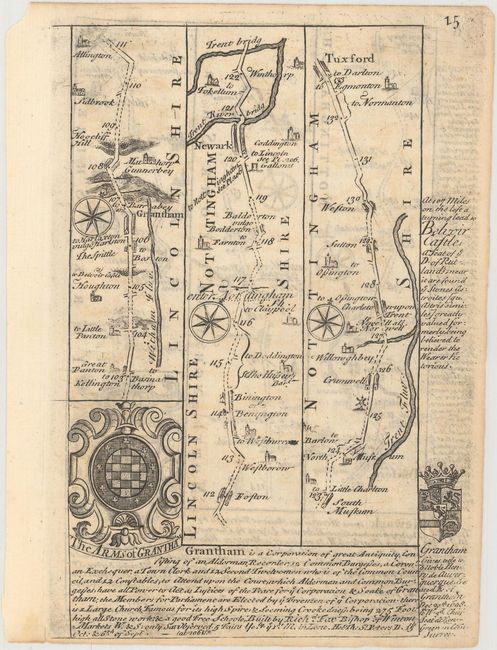
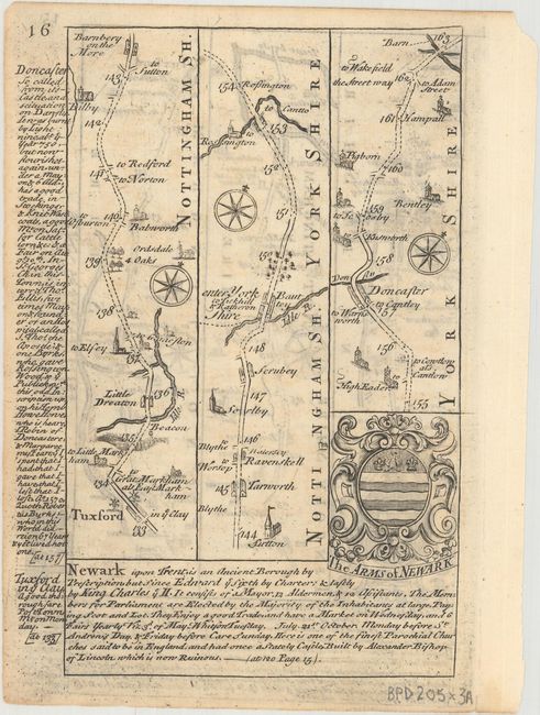
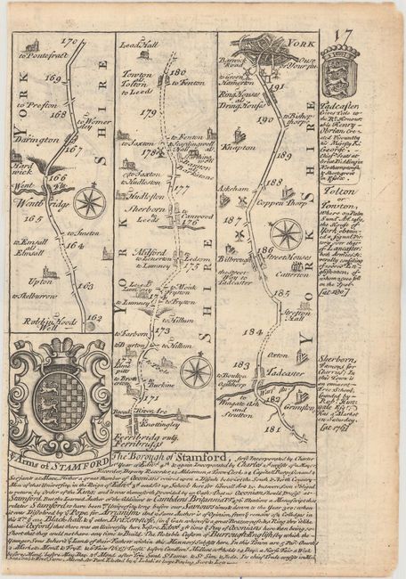
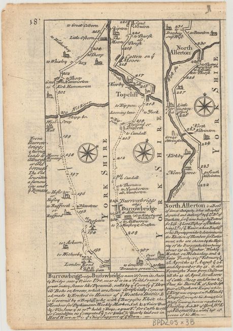
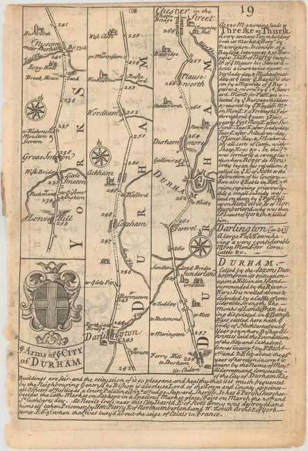
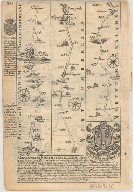
Britannia Depicta Or Ogilby Improv'd was the most popular and successful Ogilby derivative atlas, published in response to public demand for a small road atlas that could be easily carried by travelers. The atlas reproduced Ogilby's strip-style road maps and added individual county maps. It was published by Thomas Bowles in a series of editions between 1720 and 1764. The historical notes that accompany each map were compiled by John Owen, a respected lawyer and antiquarian. The maps were engraved by Emanuel Bowen who went on to become one of London's leading engravers and print sellers in the 18th century. The maps are embellished with coats of arms and contain immense detail and topographical information. A compass rose orients each map and useful landmarks include hills, bridges, rivers and streams, windmills, churches, markets, parks and forests, water wells and even gallows.
These copper engraved, Ogilby-style strip road maps include coats-of-arms and descriptive text by John Owen.
A. [The Road from London to Barwick...] From Lincolnshire through Nottinghamshire to Yorkshire.
B. [The Road from London to Barwick...] From Robin Hood's Well to Northallerton.
C. [The Road from London to Barwick...] From Lovesome Hill to Felton.
References: Shirley (BL Atlases) T.BOW-1a.
Condition: B+
Occasional light toning.