Subject: Britain
Period: 1680 (circa)
Publication:
Color: Hand Color
Size:
19.8 x 15.3 inches
50.3 x 38.9 cm
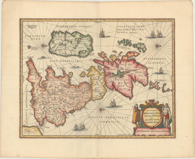
A handsome map of the British Isles that has seas filled with sailing ships, sea monsters and compass roses, with north oriented to the right. This is Jansson's historical map of the British Isles after Abraham Ortelius, crisply engraved by Petrus Kaerius. Hadrian's Wall stands as a major feature separating Scotland from England, and the Antonine Wall is noted across the central part of England as well. The interior of the map is filled with place names and charming, pictorial topography. The map is further embellished with a large and decorative title cartouche flanked by a Briton and a Celt. This is the second state with the addition of three compass roses and radiating rhumb lines. No text on verso.
References: Shirley (BI to 1650) #466; Van der Krogt (Vol. I) #5000H:1A; Phillips (A) #3427.
Condition: A
A crisp impression on a clean sheet with an extraneous crease adjacent to the centerfold and light toning along the edges of the sheet.