Subject: Guyana, Suriname, French Guiana
Period: 1760 (dated)
Publication:
Color: Hand Color
Size:
34.3 x 21.9 inches
87.1 x 55.6 cm
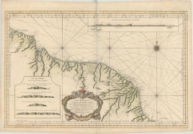
This is an early state of this magnificent, large-scale map of the coast of Guyana. It covers the region from the mouth of the Orinoco to Cabo Norte with the regions noted as being Spanish, Dutch, French and Portuguese possessions. The detail extends to include a good portion of the major rivers with the locations of forts, missions, colonial settlements, and Indian villages. Inset at top is a coastal approach view of Cayenne and inset at lower left are four other coastal views of the entrance to Cabo Orange and Cayenne. In addition to the informational nature of the chart, it is ornamented with a fine compass rose and decorative title cartouche.
References:
Condition: A
A nice impression on sturdy paper with the watermark of a double-headed eagle, minor soiling, and an archivally repaired centerfold separation that enters less than 1" into map at top. The bluish shadow along the centerfold is caused by our scanner and does not appear on the map.