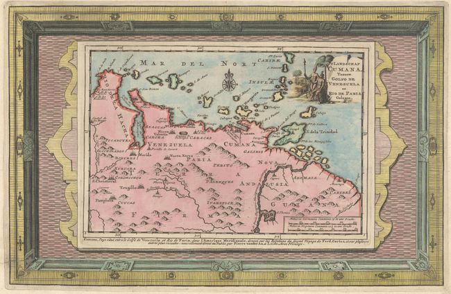
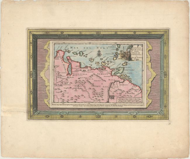
Subject: Venezuela
Period: 1715 (circa)
Publication: Cartes des Itineraires et Voyages Modernes
Color: Hand Color
Size:
13.3 x 8.6 inches
33.8 x 21.8 cm
The finely engraved map of Venezuela extends east past the Orinoco River to the Essequibo River, and locates key cities, including San Cristobal, Merida, and Cumana. The ABC Islands and the Windward Islands are shown up to St. Lucia. The map depicts the region traveled by Hernan Cortes, a Spanish Conquistador who conquered Mexico circa 1520 and caused the fall of the Aztec Empire. Decorated with a compass rose and title cartouche featuring natives and indigenous animals. This is the much more decorative, and uncommon state with the map enclosed in a superb picture frame-style border that was printed from a separate plate, giving an incredible 3-dimensional quality.
References:
Condition: A
Excellent impression on wide-margined paper with a fleur-de-lis coat of arms watermark. There is marginal soiling and an archivally repaired tear that enters less than 1" into map border at bottom left.