Subject: Barbados
Period: 1720 (circa)
Publication: Grosser Atlas Uber die Gantze Welt...
Color: Hand Color
Size:
11 x 13.4 inches
27.9 x 34 cm
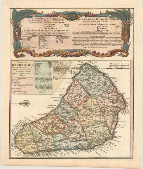
This bold copper-engraved map of Barbados was copied from Moll's map of 1729. The island is divided into parishes, with numerous cities, churches, plantations, and roads depicted. A decorative compass rose orients west at the top of the map. Contained in the title cartouche are a legend, a list of the eleven parishes with their population, and a note giving a brief history of Barbados from the reign of King James I. The Barbados map was one of five maps on the sheet, including St. Kitts, Antigua, Bermuda, and Jamaica, which have been trimmed from this folio sheet. Above the map is an elaborate title cartouche for the whole sheet in both Latin and German, decorated with coconut trees and local flowers.
References: Campbell (MCC-21) #26.
Condition: A
A nice impression, remargined at bottom and left to accommodate framing.