Subject: Martinique
Period: 1650 (circa)
Publication: Cartes Generales de Toutes les Parties du Monde
Color: Hand Color
Size:
17.1 x 12.6 inches
43.4 x 32 cm
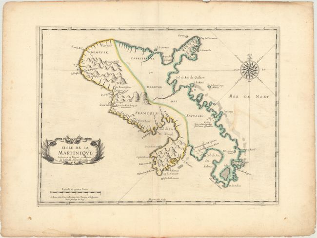
This is the first printed folio map devoted to the island of Martinique, which was first colonized by the French in 1635. The focus of the map is the division of the island between the French colonists and the "savages." On the eastern portion of the island, there are only two villages noted, both named for important caciques on the island: one near Cap Louys (Vauclin Point) where the Caribbeans meet, and one for Capitaine Pilote near Le Marin. Mount Pelee is on the western side of the island near the first French settlement of St. Pierre, where the French also built a fort. The house of "Mr. du Parquet" is also noted; Jacques Dyel du Parquet was the Governor of Martinique from 1636 until his death in 1658. The map also shows the locations of several Jesuit missions. Engraved by Abraham Peyrounin.
References:
Condition: B+
Contemporary outline color on paper with a bunch of grapes watermark. There is light soiling and extraneous creasing in the map. The edges of the sheet are moderately soiled with a number of tiny tears.