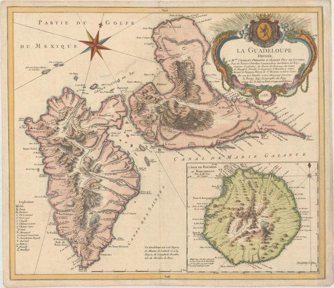
Subject: Guadeloupe
Period: 1788 (dated)
Publication: Atlas Ameriquain
Color: Hand Color
Size:
21.1 x 18.3 inches
53.6 x 46.5 cm
This handsome chart shows Guadeloupe. The islands of Basse-Terre and Grande-Terre are depicted in fine topographical detail along with some smaller surrounding islands. A key at bottom left identifies towns, parishes, battlegrounds, batteries, forts both defunct and operational, anchorages, and more. A large inset at bottom right covers Reunion (here called Isle de Bourbon or Mascareigne), which lies east of Madagascar in the Indian Ocean, and includes a notation that the island was included on this sheet only to fill the empty space, despite the fact that Reunion is far from Guadeloupe. The map is adorned with an ornate decorative title cartouche at top right.
References: Sellers & Van Ee #2007; Shirley (BL Atlases) T.LER-3a #26.
Condition: B+
A nice impression on paper with a large house watermark and very light soiling.