Subject: World
Period: 1778 (circa)
Publication: Atlas General et Elementaire
Color: Hand Color
Size:
18.8 x 10.9 inches
47.8 x 27.7 cm
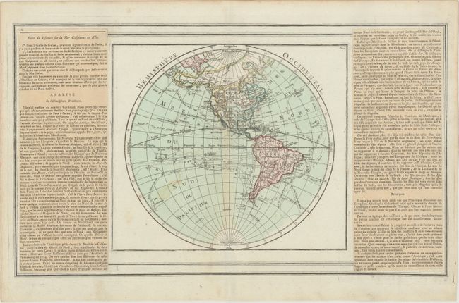
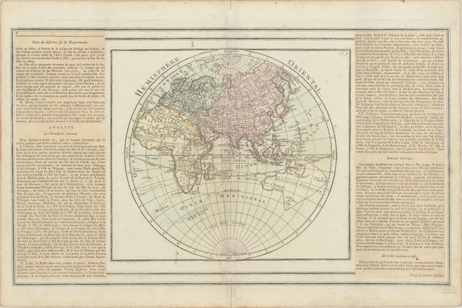
Pair of very attractive hemisphere maps, each surrounded in plain border with that was printed from a separate copper plate. In the Western Hemisphere, Brion has devised an ingenious way to show the competing theories of the Pacific Northwest. One hypothesis is engraved in dotted lines and colored in green, and another version, engraved in hachure and colored in yellow, shows the Sea of the West and Northwest Passage. In the Eastern Hemisphere, Australia is partially mapped and then completed into an odd shape by hachures connecting Tasmania and New Guinea. Both maps include numerous explorers' routes and important recent discoveries. Each sheet measures 18.8 x 11.0" with the panels of French text, which were printed on separate sheets and pasted adjacent to the maps. Brion de la Tour's Atlas General et Elementaire was first published in 1766, with subsequent editions in 1767, 1768, 1778, 1782, and 1786.
References: McGuirk #129; Shirley (BL Atlases) T.BRI-3a.
Condition: B+
Original color on watermarked paper with light soiling and minor toning along the centerfolds and edges of the sheets. The map of the eastern hemisphere has an archivally repaired centerfold separation that just passes the neatline at bottom.