Subject: Gulf of Mexico, Florida & Peru
Period: 1592 (circa)
Publication: Theatrum Orbis Terrarum
Color: Hand Color
Size:
18 x 13.1 inches
45.7 x 33.3 cm
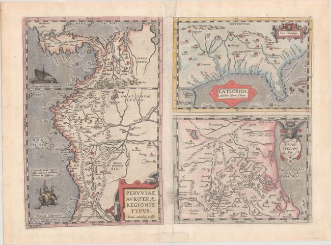
This was one of the few sixteenth century maps based on Spanish sources; in this case drawing from reports of Hernando de Soto's expedition through the region. There are three maps on this sheet. The most important map, La Florida, is the first printed map of the southern portion of the United States. This influential map provided the foundation cartography for the region, particularly in the depiction of the river systems. The map below (Guastecan Reg) combines with La Florida to extend the coastline of the Gulf of Mexico further south. The third is a map of Peru, where De Soto was the first Spaniard to meet Inca Emperor Atahuallpa. In the north of the map of Peru is Aurea Regio, or Kingdom of Gold, a reference to the fabled El Dorado. All maps contain decorative cartouches, and the map of Peru is embellished with two ships. Latin text on verso, published between 1592-1612.
References: Burden #57; Cumming (SE) #5; Van den Broecke #15.
Condition: B+
On watermarked paper with several worm tracks along the centerfold that only impact the left border of the two maps at right and have been closed on verso with tissue. Small pieces of old paper have been added on recto in the top and bottom margins for reinforcement.