Subject: Eastern Wisconsin, Lake Michigan
Period: 1836 (dated)
Publication: Sen. Doc. 175, 25th Congress, 2nd Session
Color: Black & White
Size:
20.2 x 14.2 inches
51.3 x 36.1 cm
This lot contains five early charts of Wisconsin rivers surveyed by Lieuts. A. J. Center and E. Rose. The charts show breakwaters into Lake Michigan, numerous soundings, and ground types. Size varies slightly.
A. Survey of the Entrance to Milwaukie, Wisconsin. Locates Bois Gris Creek, Walker's Point and the Menomonie River.
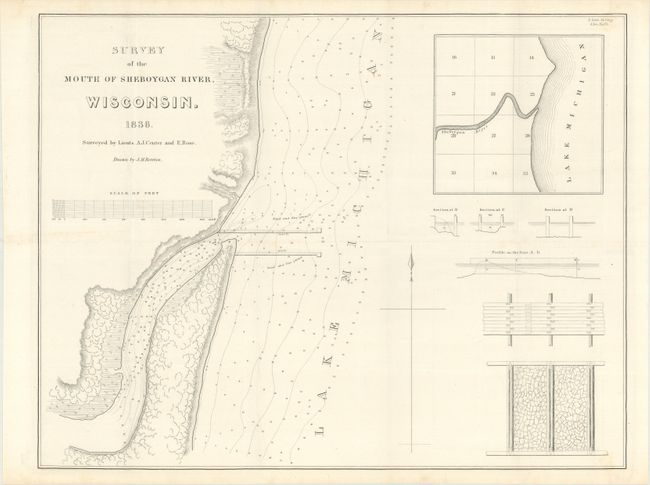
B. Survey of the Mouth of Sheboygan River, Wisconsin. Chart of the river mouth at the location of the present-day city of Sheboygan. Includes an inset of the broader region. This is the first chart of the vicinity of the city.
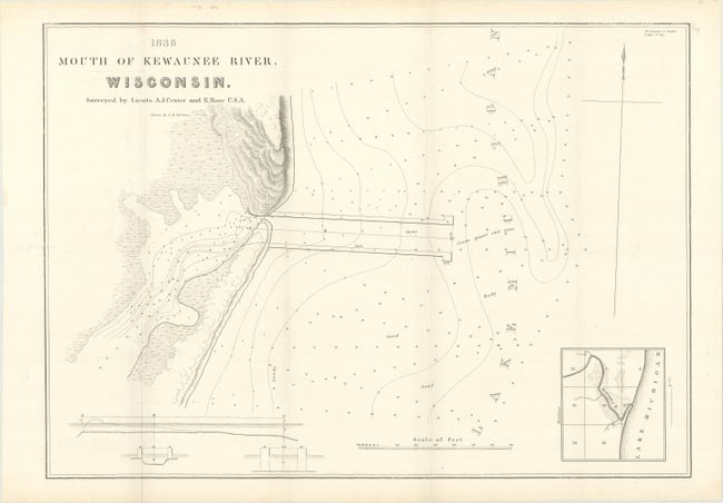
C. Mouth of Kewaunee River, Wisconsin. This is the first printed plan of the Kewaunee city area. It gives good detail of the constructed waterway into Lake Michigan, but no sign of any settlement at this point. Includes a small inset of the area.
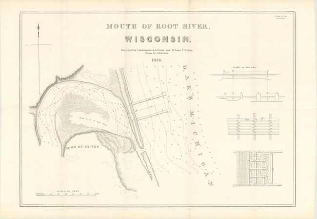
D. Mouth of Root River, Wisconsin. Identifies the town of Racine but provides no developmental detail.
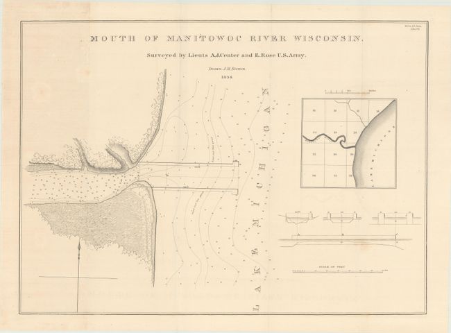
E. Mouth of Manitowoc River Wisconsin. A 900-foot long breakwater is shown. Smaller images include cross-sections of the breakwater and a regional inset.
References: Claussen & Friis #193-95 & 197-98.
Condition: B+
Issued folding on clean sheets. There are a few spots of faint foxing, and the map of the Manitowoc River has light toning.