Subject: Washington
Period: 1876 (dated)
Publication:
Color: Black & White
Size:
31.7 x 24.1 inches
80.5 x 61.2 cm
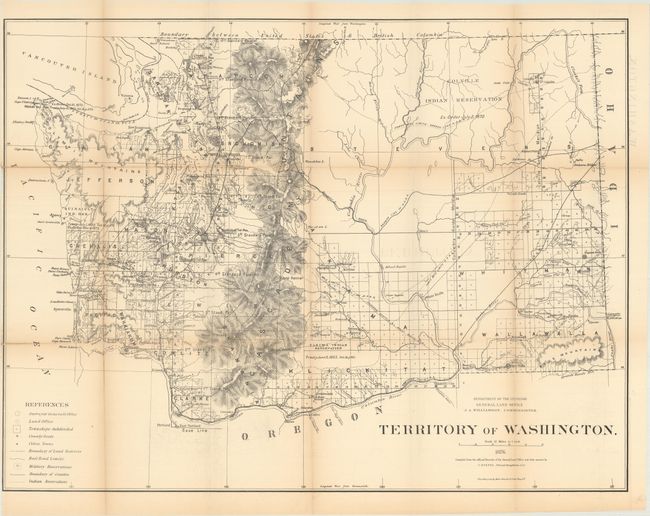
This large survey map was compiled under the direction of Charles Roeser. Development is concentrated in the area west of the Cascades and along the line of the Northern Pacific Railroad. The large Colville Indian Reservation is identified in the northeast, and the smaller Yakima Indian Reservation is depicted in the south. The map also identifies land offices, military reservations, railroad limits, and more. The General Land Office produced this map as part of a series of maps of the states and territories to celebrate the Centennial. These maps were recognized as the most accurate and detailed maps of their time, and subsequently were widely used by commercial mapmakers.
References:
Condition: B+
Issued folding with light toning and faint offsetting. There are a number of small fold separations that have been partially closed on verso with archival tape. Narrow left margin.