Catalog Archive
Auction 169, Lot 298

"Map of the Great Salt Lake and Adjacent Country in the Territory of Utah [on sheet with] The Great Salt Lake (Mormon) City and Surrounding Country", Weller, Edward

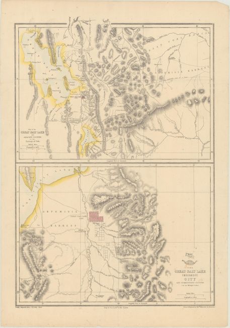
Subject: Salt Lake City, Utah

Period: 1860 (circa)

Publication: Weekly Dispatch Atlas

Color: Hand Color

Size:
12 x 17.3 inches
30.5 x 43.9 cm
Download High Resolution Image
(or just click on image to launch the Zoom viewer)

This sheet contains two maps. The upper map covers the region from the Great Salt Lake and Lake Utah east to Vernal and the Ashley Creek area (unnamed) and Fort Bridger in the north. It shows Salt Lake City in a block plan and also locates Ogden, but there is no sign of Logan. Fort Utah is on the eastern shore of Lake Utah. The lower map is centered on Salt Lake City and features much more detail. The city plan clearly shows its rectangular grid layout and wide streets. The Welsh Settlement is shown to the southwest on the other side of the Jordan River. Both maps delineate the mountains in hachure and good detail of watershed. Lithographed by Day & Son. Drawn and engraved by Edward Weller of Bloomsbury.

References:

Condition: B+

There is light toning and a few spots of foxing.

Estimate: $140 - $170

Sold for: $170

Closed on 9/12/2018

Archived