Subject: Texas
Period: 1875 (circa)
Publication: Atlas of the United States
Color: Hand Color
Size:
14.3 x 16.4 inches
36.3 x 41.7 cm
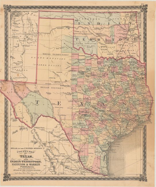
This is only the third map that we have encountered in the last 20 years that shows the proposed Wigefarth County in the lower Panhandle along the border of Indian Territory. The county line is only partially engraved with the northern border defined in color alone. The existing network of roads, trails and railways is minutely detailed and includes several railways that were not actually completed. Indian Territory is divided among eleven Native nations. Published by Harrison & Warner from H.H. Lloyd's Atlas of the United States.
References:
Condition: B
There are several small stains along the left border and a larger faint dampstain at right. An edge tear at top right extends 0.75" into the image that has been closed on verso with archival tape.