Catalog Archive
Auction 169, Lot 288

"Map of Rhode Island and Providence Plantations; Corrected and Enlarged with Many Additions", Lockwood, Benoni

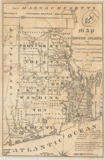
Subject: Rhode Island

Period: 1819 (dated)

Publication: Gazetteer of Rhode Island

Color: Black & White

Size:
6.8 x 10.4 inches
17.3 x 26.4 cm
Download High Resolution Image
(or just click on image to launch the Zoom viewer)

A great, early state map showing townships and county boundaries, roads, factories, academies and distilleries. Both the "Charter Line" and "Jurisdiction Line" with Massachusetts are shown at top, and the northern tip of Block Island is shown at the bottom with the note "Part of Block Island upon which is the Town of New Shoreham." Decorated by the arms of the state at top. Published by William S. Marsh.

References:

Condition: B+

Issued folding and now flattened and backed with heavy tissue to reinforce and repair a few minor fold separations and short edge tears. There is light toning and offsetting.

Estimate: $80 - $100

Sold for: $35

Closed on 9/12/2018

Archived