Catalog Archive
Auction 169, Lot 285

"Progress of Survey and Subdivision Indian Territory", U.S. Department of Interior
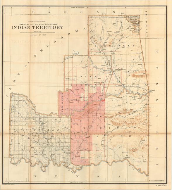
Subject: Oklahoma

Period: 1896 (dated)

Publication: HR Doc. 243, 54th Congress, 1st Session

Color: Printed Color

Size:
26.6 x 28.7 inches
67.6 x 72.9 cm
Download High Resolution Image
(or just click on image to launch the Zoom viewer)

This uncommon map exactly matches the configuration of the State of Sequoyah the Indians attempted to create in 1905 in an effort to thwart the expansive tendencies of the United States. The regions of the Chickasaw, Choctaw, Creek, Seminole, Cherokee, and several other Indian tribes are named. The Territory of Oklahoma hovers ominously in the northwest. This historical map was compiled and drawn by R.P. Lowe, traced and lettered by Wm. Naylor. Lithography by the Norris Peters Company.

References:

Condition: B+

Issued folding with light toning and offsetting. Several small fold separations have been closed on verso with archival tape.

Estimate: $300 - $375

Sold for: $150

Closed on 9/12/2018

Archived