Subject: New Mexico
Period: 1894-98 (circa)
Publication:
Color: Printed Color
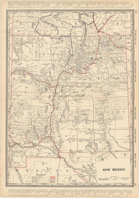
A. New Mexico, by George Cram, from Railway Atlas, circa 1894 (16.3 x 22.4"). This terrific atlas map of New Mexico features numerous counties, place names, rivers, and post offices. It also includes some nice topographical detail. The eight railroads in this example are shown in color, and a pair of indexes along the side borders list the other maps found in the atlas. Condition: Marginal soiling. (A)
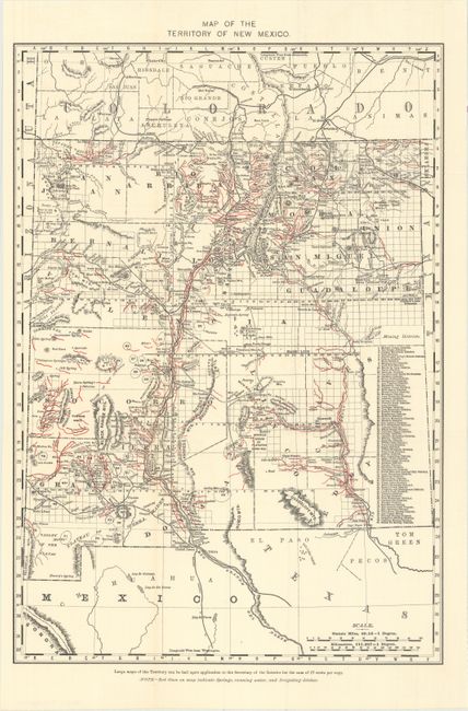
B. Map of the Territory of New Mexico, by General Land Office, circa 1898 (13.1 x 18.8"). This detailed map identifies 80 mining districts which are listed in a table along the right margin. A note in the lower margin states "Red lines on map indicate springs, running water, and irrigating ditches." Condition: Issued folding. (A+)
References:
Condition:
See description above.