Subject: New Mexico
Period: 1846-47 (dated)
Publication:
Color: Black & White
Size:
19.7 x 25 inches
50 x 63.5 cm
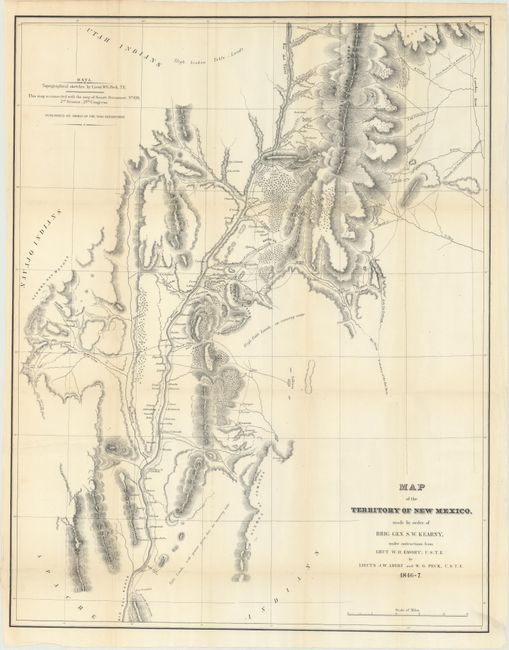
During the War with Mexico, Lieutenants Abert and Peck were en route to the Pacific with Lieut. Emory as part of General Kearny's Army of the West, but the two were left behind due to illness. They took the opportunity to continue their survey efforts earlier started on Fremont's third expedition. The resulting map is a very detailed look at the Rio Grande Valley and some adjacent areas including the pueblos of Laguna and Acoma. This important map, illustrated in Wheat, is roughly centered on Santa Fe. It details the territory along the Rio Grande from above Taos south to well below Socorro and San Antonio to the ruins at Valverde. Excellent detail of the topography and watershed to either side of the river with the mountains shown via hachure. Filled with place names including numerous villages and small towns, and the Comanche Route from Arkansas. Blank areas to the west and north are labeled Navajo Indians and Utah Indians.
References: Wheat (TMW) #532; Wagner-Camp #148.5.
Condition: B+
Issued folding with a hint of toning along the fold lines and light extraneous creasing. There is one repaired edge tear at left that just enters the border.