Subject: Arizona
Period: 1901-07 (dated)
Publication:
Color: Printed Color
Size:
16.9 x 20.1 inches
42.9 x 51.1 cm
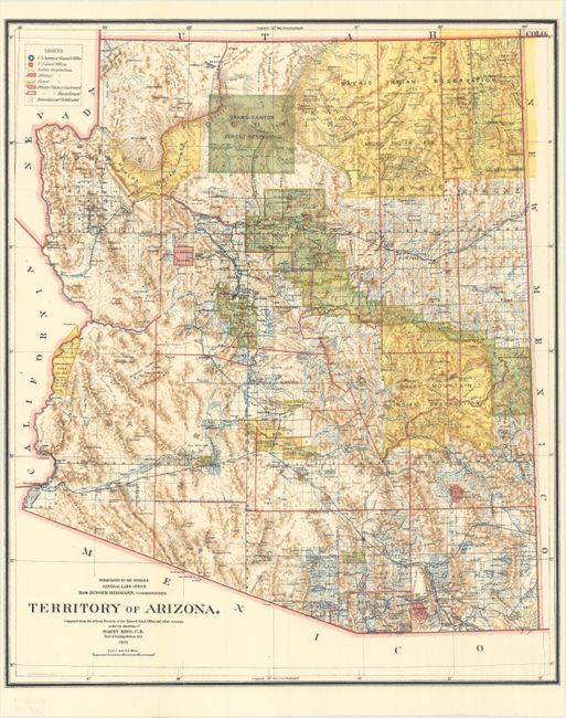
A. Territory of Arizona, dated 1901. A colorful and fascinating map with great detail issued eleven years before statehood. The extent of nine Indian reservations and at least three Military reservations, including Camp Apache, are clearly shown in different colors. Numerous confirmed and unconfirmed land claims are named and located. A huge Grand Canyon Forest Reserve is shown. The brown hachured mountain area and the blue waterways combine to provide great visual impact. Information includes watershed, mountains, railroads, wagon roads, private claims, unsurveyed townships, etc. A beautiful example published while Harry King was the Chief of Drafting and the Hon. Binger Hermann was commissioner.
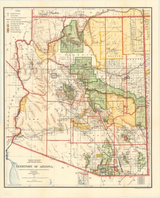
B. Territory of Arizona, dated 1907. An updated map from above, five years before Arizona attained statehood. The map clearly shows Indian Reservations, Military Reservations (Fort Apache, Fort Grant, Fort Huachuca and Fort Whipple), and Forest Reserves via different colors. The new Petrified Forest National Monument (established in 1906) is located east of Holbrook.
References:
Condition: A+
Fine. Issued folding.