Subject: Colonial Southeast United States
Period: 1680 (circa)
Publication:
Color: Hand Color
Size:
19.8 x 15.1 inches
50.3 x 38.4 cm
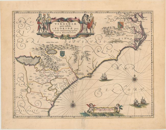
This lovely map of the Southeast extends from the southern part of Chesapeake Bay to northern Florida. Cartographically it improves on the Hondius map of 1606, on which it was derived, with the Chesapeake Bay correctly indicated as a large bay and the Carolinas and Georgian coasts depicted more accurately. The map presents the English and French colonial interests in the region as depicted by their respective royal arms. At the southern end of the Appalachians is a note concerning gold and silver mines. Richly decorated with a large cartouche flanked by Native Americans. The Atlantic Ocean contains two compass roses, three sailing ships and two aquatic putti holding the German scale of miles. This is the second state of the map with a blank verso, likely published after the plates were sold in 1677.
References: Burden #253; Van der Krogt (Vol. II) #9400:2.
Condition: B+
A nice impression with contemporary color that was retouched in the turquoise elements, light printer's ink residue, and a couple of unobtrusive spots. There are archival repairs to a centerfold separation that enters 1/2" into image at bottom and to a tear at bottom left and another centerfold separation at top that are both confined to the blank margin.