Subject: Mid-Atlantic United States
Period: 1838-65 (circa)
Publication:
Color: Hand Color
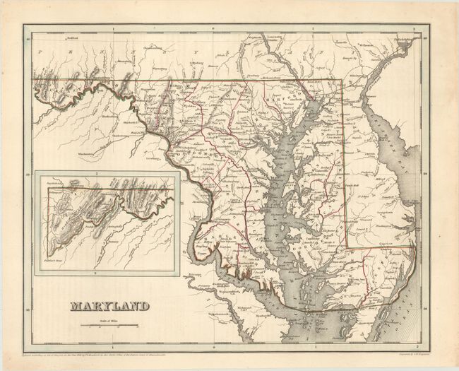
A. Maryland, by T.G. Bradford, dated 1838 (13.9 x 11.3"). An attractive copper-engraved map delineated by county that extends into neighboring Virginia, Delaware, and Pennsylvania. Shows several early railroads connecting Baltimore with Philadelphia, Lancaster, Frederick, and Washington D.C. A canal is shown following the Potomac River from Cumberland to Washington. Includes an inset of the western tip of the state on the same scale. Condition: A crisp impression with a hint of offsetting from an opposing page of text. (A)
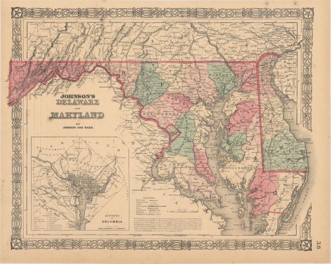
B. Johnson's Delaware and Maryland, by Johnson and Ward, circa 1865 (16.4 x 12.8"). This map of the state includes a detailed inset of the District of Columbia with 12 points of interest keyed to the map. It presents the evolving transportation network in the region as well as cities, towns, post offices, and more. Surrounded by a beautiful strapwork border. Condition: Light toning and minor foxing. (B+)
References:
Condition:
See description above.