Subject: Colonial Mid-Atlantic United States
Period: 1756 (published)
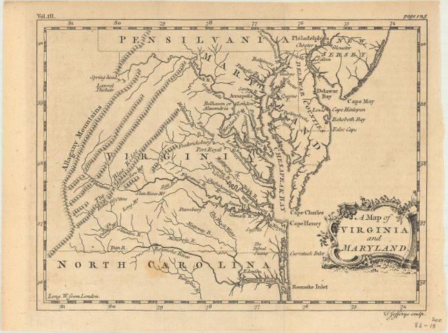
Publication: A Compendium of Authentic and Entertaining Voyages
Color: Black & White
Size:
7.8 x 5.8 inches
19.8 x 14.7 cm
Thomas Jefferys was one of the most important English map publishers of the 18th century. His work included prints and maps of locations around the world, but his most notable maps are of North America and the West Indies. He began his career in the map trade in the early 1730s, working as an engraver for a variety of London publishers, and eventually setting up his own shop. In 1746, he was appointed Geographer to the Prince of Wales, and in 1760 he became Geographer to the King. These titles granted access to manuscripts and cartographic information held by the government. In the early 1760s he embarked on an ambitious project to produce a series of English county maps based on new surveys, but ran out of money and filed for bankruptcy in 1766. He then partnered with London publisher Robert Sayer, who reissued many of Jefferys plates and continued to issue new editions after Jefferys' death in 1771. Jefferys' American Atlas and the accompanying West-India Atlas, published post posthumously, are considered his most important cartographic works.
This seldomly seen map appeared in Tobias Smollett's A Compendium of Authentic and Entertaining Voyages, published in London by R. & J. Dodsley. The map focuses on the topography and towns in the region, and extends to show Delaware and parts of North Carolina, Pennsylvania and New Jersey. The dotted borders between the states are quite irregular, and appear to have been drawn freehand. The map appears to be a derivative of the Fray & Jefferson map of Virginia from 1753 based on the shape of the Delmarva Peninsula. This map was later re-engraved by H. Gavin and included in the 1767 edition of Thomas Salmon's A New Geographical and Historical Grammar.
References: Maryland State Archives #256J4; cf. Sellers & Van Ee #1391 (Gavin edition); cf. Wooldridge #108 (Gavin edition).
Condition: B+
Issued folding on watermarked paper with one light spot.