Catalog Archive
Auction 169, Lot 174

"Carte de la Nouvelle Angleterre, Nouvelle York et Pensilvanie pour Servir a l'Histoire Philosophique & Politique des Etablissemens et du Commerce des Europeens dans les Deux Indes", Bellin, Jacques Nicolas

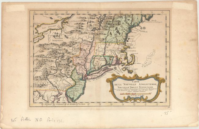
Subject: Colonial New England & Mid-Atlantic United States

Period: 1783 (circa)

Publication: Atlas Portatif pour...Histoire Philosophique et Politique...

Color: Hand Color

Size:
11.6 x 7.9 inches
29.5 x 20.1 cm
Download High Resolution Image
(or just click on image to launch the Zoom viewer)

This French & Indian War period map details the English colonies from Pennsylvania through Penobscot Bay in Maine, with their early boundaries. It is fully engraved with topographical features and includes many early place names. The colonies are shown confined east of the Allegheny Mountains with the Nations Iroquoises, Indian villages, and several French forts located west of the mountains. It extends to show Lake Ontario and most of Lake Erie. A flourishing French rococo-style cartouche with distance scale decorates the map.

References: McCorkle #757.1; Sellers & Van Ee #721.

Condition: B+

A dark impression with a small tear adjacent to the centerfold (Long Island) and light toning. There are minor tape stains in the blank margins.

Estimate: $200 - $230

Sold for: $150

Closed on 9/12/2018

Archived