Catalog Archive
Auction 169, Lot 135

"Partie de l'Amerique Septent? qui Comprend la Nouvelle France ou le Canada", Robert de Vaugondy, Didier

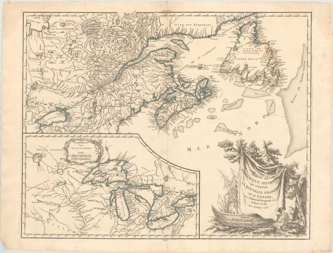
Subject: Colonial Northeastern United States & Canada, Great Lakes

Period: 1755 (dated)

Publication: Atlas Universel

Color: Hand Color

Size:
23.9 x 19 inches
60.7 x 48.3 cm
Download High Resolution Image
(or just click on image to launch the Zoom viewer)

This is a handsome map of Newfoundland, Nova Scotia, and the entire course of the St. Lawrence River. The most prominent feature of the map is the very large inset of the 1744 Bellin version of the Great Lakes. The wonderful cartouche features the title on a blanket draped over a wooden canoe, which appears beside a threatening beaver. This is the second state of the map, naming three islands in James Bay.

References: Kershaw #355; Pedley #459; Sellers and Van Ee #61; Karpinski p.141-42; McCorckle #755.36.

Condition: A

On watermarked paper with one tiny rust spot and a few tiny professionally repaired centerfold separations at top.

Estimate: $600 - $750

Sold for: $450

Closed on 9/12/2018

Archived