Subject: Colonial Northeastern United States & Canada, Great Lakes
Period: 1742 (circa)
Publication: Atlante Novissimo
Color: Hand Color
Size:
17 x 13 inches
43.2 x 33 cm
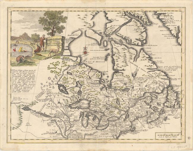
This is the beautifully engraved Italian edition of Delisle's important map of Eastern Canada and New England, including all of the Great Lakes, Labrador, and Hudson Bay. The map features Baron Lahontan's imaginary Longue Riviere, which is shown rising in distant western mountains and emptying into the upper Mississippi River. There is Italian text to the left of the map discussing the Longue Riviere, here called Il Fiume Longo. The Great Lakes are mostly correct, with a few phantom islands persisting in Lake Superior. Locations of numerous forts and Indian tribes are noted throughout the map. It is adorned with a large, pastoral cartouche featuring a strange sea creature resembling something between a Labrador Retriever and a mermaid.
References: Kershaw #342; Phillips (A) #594-40.
Condition: B+
On a watermarked sheet with light offsetting and a short centerfold separation confined to the top blank margin.