Subject: Eastern Canada
Period: 1747 (circa)
Publication: A Complete Atlas, or, Distinct View of the Known World
Color: Hand Color
Size:
16.8 x 13.7 inches
42.7 x 34.8 cm
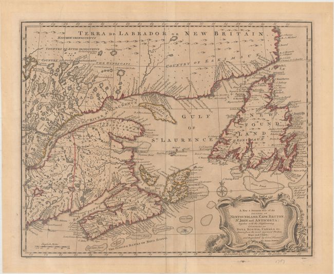
This attractive map of the Gulf of St. Laurence is based on Bellin's definitive map of 1744. It is very detailed with hundreds of place names, especially along the coastlines. The major fishing banks are well delineated. There is a large decorative title cartouche and compass rose at bottom right. This is the second state with "No. 63" at the bottom left. It appeared in both A Complete System of Geography... (first published 1747) and A Complete Atlas, or, Distinct View of the Known World... (published 1752), which featured the same maps without text and in a slightly different order.
References: McCorkle (18th c. Geography Books) #17-32 (Vol II); Shirley (BL Atlases) T.BOW-2a #62; Kershaw #694; Phillips (A) #603-62.
Condition: B
A nice impression on a lightly toned and watermarked sheet with a 3.25" archivally repaired edge tear at bottom and a pair of worm holes at bottom left and right. There is an extraneous crease running perpendicular to the centerfold.