Subject: Colonial Eastern North America & West Indies
Period: 1747 (circa)
Publication: A Complete System of Geography
Color: Hand Color
Size:
16.8 x 13.8 inches
42.7 x 35.1 cm
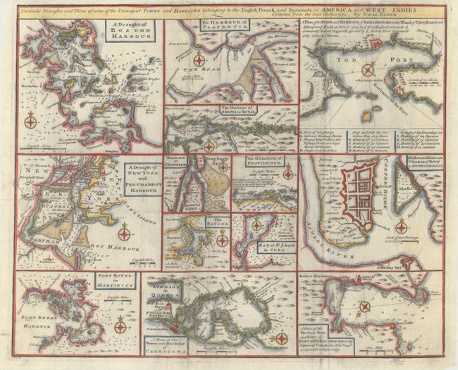
An unusual copper engraving featuring thirteen small maps of colonial towns and sea ports including New York, Boston, Charleston, Cartagena, Martinico, St. Augustine, Havana, etc. Each map includes its own compass rose and scale of miles, and most focus on the waterways, with depth soundings, rocks, and shoals noted to aid in navigation. One of the central maps, "The Harbour of Providence," depicts Nassau, New Providence in the Bahamas, and notes that this English port is "the best planted & fortified of all the Bahama islands." At top right, the plan of Louisbourg on Cape Breton Island notes the recent British victory over the French and includes a key identifying the various batteries and the "stages on which they dress and salt the cod before they dry them."
References: Shirley (BL Atlases) T.BOW-2a #63.
Condition: B+
A crisp impression, issued folding, with light soiling and some extraneous creases that have been pressed flat. There are professional repairs to some separations and tiny tears along the folds, as well as to a tear that enters about 1" into image at top center.