Subject: North America
Period: 1859-65 (circa)
Publication:
Color: Hand Color
This set of maps provides a great study of the rapid settlement and changes taking place in the western United States in the span of only six years.
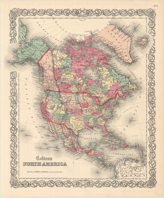
A. Colton's North America, by Johnson and Browning, dated 1859 (13.3 x 15.8"). Attractive steel engraved map that is filled with political and topographical detail throughout. Alaska is Russian America, Nebraska extends to the Canadian border, the new Dakotah Territory has been carved out of Minnesota, Washington is in its inverted "L" shape, Utah is shown in its fullest extent, the proposed Arizona Territory is shown below New Mexico, and Oklahoma is entirely Indian Territory. Decorative border. Condition: Fine. (A+)
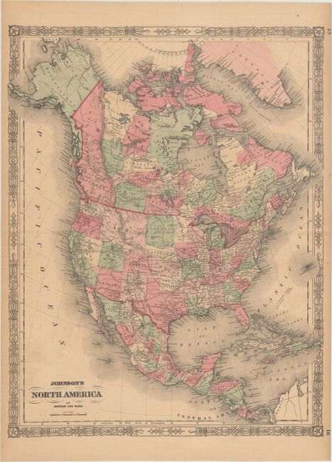
B. Johnson's North America, by Johnson and Ward, circa 1863 (17.2 x 22.3"). A colorful double-page map of the continent with Alaska still a Russian possession. In the United States, a huge Idaho Territory encompasses all of present-day Montana, Wyoming and Idaho. Arizona still engulfs Nevada's southern tip. The Pony Express Route and U.S. Mail Routes are depicted. Condition: There is light toning, offsetting, and a few spots of foxing. (B+)
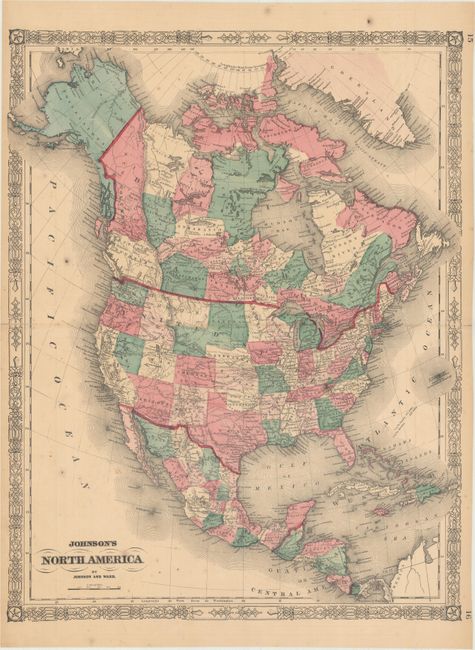
C. Johnson's North America, by Johnson and Ward, circa 1865 (17.1 x 22.2"). An updated version of the map above that shows Montana carved out of Idaho Territory. Dakota Territory now assumes the unnamed Wyoming. Condition: Light toning and minor foxing. There are minor fold separations confined to the blank margins that have been closed on verso with archival tape. (B+)
References:
Condition:
See description above.