Subject: North America
Period: 1810-27 (circa)
Publication:
Color: Black & White
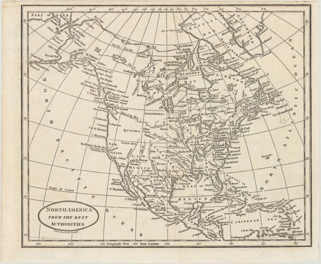
A. North America from the Best Authorities, by Benjamin Baker, circa 1810 (9.1 x 7.7"). This small map of North America shows the United States boundary along the Mississippi River. Florida is divided into East and West. Sir Francis Drake's Harbor is shown on the coast of present-day California which is labeled New Albion. A prominent River of the West flows into the Pacific at the Entrance of Juan de Fuca and an elaborate, appcryphal Northwest Passage links Hudson Bay with Prince William Sound through a laborious system of rivers and lakes in Canada.
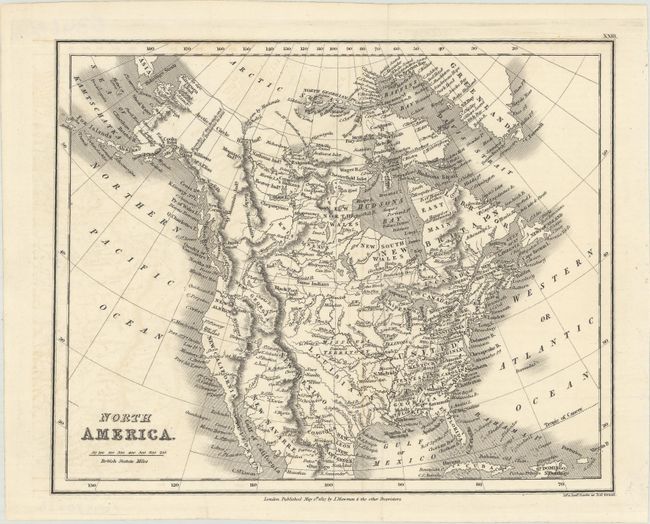
B. North America, by Joseph Mawman, dated 1827 (9.5 x 7.6"). A slightly later map from the above with the United States boundary still along the Mississippi River. To its west is a large region labeled both Missouri Territory and Louisiana. The Pacific Northwest is labeled New Georgia, with New Albion and New California to its south.
References:
Condition: A
Nice dark impressions, issued folding. The second map has a hint of offsetting at left.