Subject: North America
Period: 1784 (circa)
Publication: A Philosophical and Political History...in the East and West Indies
Color: Black & White
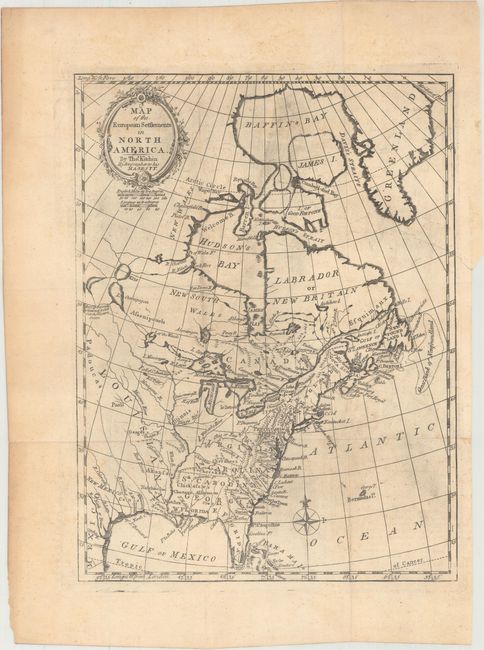
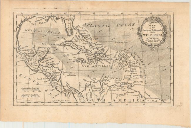
A nice pair of maps issued in Abbe Raynal's A Philosophical and Political History of the Settlements and Trade of the Europeans in the East and West Indies. Each map is adorned with a garland-style title cartouche and two distance scales.
A. Map of the European Settlements in North America (9.5 x 12.6"). This map covers the eastern part of North America from Greenland to Florida with settlement confined to the eastern seaboard. Numerous Indian names are noted throughout. A comment by L. Ouinipigon alludes to a Northwest Passage: "R. of ye Assenpouels supposed to fall into the Western Ocean."
B. Map of the European Settlements in the West Indies (10.6 x 6.3"). This detailed map of the West Indies extends to cover parts of North America, Central America, and the northern coast of South America. Florida's southern tip is still coming into form with two large islands off the mainland. The map is filled with coastal place names, rivers, mountains, and current directions.
References:
Condition: B+
Issued folding with light toning, minor offsetting, and a few spots of foxing. The map of North America has a 1.5" binding tear at right that has been closed on verso with archival tape.