Subject: Colonial North America
Period: 1782 (published)
Publication: Guthrie's New Geographical Grammar
Color: Hand Color
Size:
14.3 x 13.3 inches
36.3 x 33.8 cm
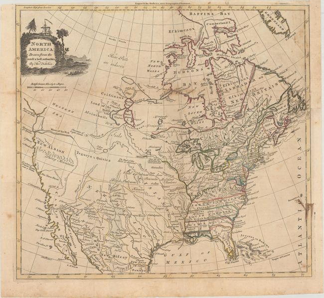
This map was issued shortly before the end of the Revolutionary War and shows good detail in the east with Virginia, the Carolinas, and Georgia extending to the Mississippi River. The Gulf Coast is comprised of East and West Florida, with West Florida also extending to the Mississippi. There are numerous early frontier settlements, forts, Buffalo Meadows, and Indian nations located. In the Pacific Northwest, the Straits of Juan de Fuca open up to a huge, but undefined Western Sea. The River of the West conjecturally flows from Pikes Lake in the Intermountain West. New Albion and the Snowy Mountains are prominently shown, but the western region is mostly blank. The Missouri River is partly delineated with "the head of this River unknown." New Mexico is a large area that includes Texas with several Indian pueblos located. Central Canada has a bizarre set of lakes and river systems as is commonly seen in this period.
References: McGuirk #172.
Condition: B+
Issued folding on watermarked paper with light toning and scattered foxing. There is a 1" edge tear at right and a few tiny fold separations that have been repaired on verso with archival materials.