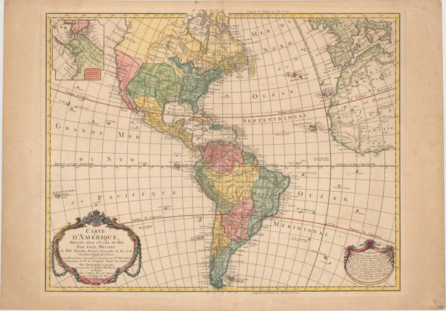
Subject: Western Hemisphere - America
Period: 1785 (dated)
Publication: Atlas Geographique des Quartes Parties du Monde
Color: Hand Color
Size:
23.6 x 18.8 inches
59.9 x 47.8 cm
This is a later, updated edition of the important map that was first issued by Delisle in 1722. It was one of the most popular maps of the 18th Century. The new United States is noted extending to the Mississippi River, but the individual state boundaries are still shown on the Appalachian Mountains. The map shows a number of spurious mountains ranges in the West, going east to west and north to south, and sometimes doing both within the same range. This edition shows an inset of Cook's explorations in the Pacific Northwest, but without the related key from the earlier edition. The map was published in 1789, and still has the royal seal and crown on the top of the cartouche, which was removed after the establishment of the French Republic in 1792.
References: Tooley (Amer) p. 15, #10.
Condition: B+
On watermarked paper with faint scattered foxing and light offsetting of the title cartouche at lower right. There is a light printer's crease to the right of the title cartouche and light toning confined to the blank margins.