Subject: Western Hemisphere - America
Period: 1776 (published)
Publication: Atlante Novissimo
Color: Hand Color
Size:
15.8 x 12 inches
40.1 x 30.5 cm
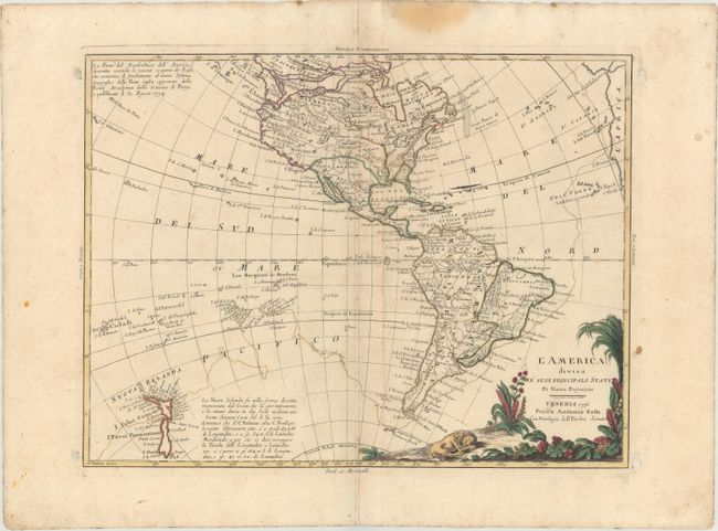
This handsome map of the Americas depicts the first voyage of Capt. Cook around South America and across the Pacific to New Zealand. In North America a variety of interesting cartographic theories are evident. The mythical Northwest Passage and the supposed discoveries of Admiral de Fonte are prominently depicted in the northern region. The interior river systems illustrates the persistent belief in a network of navigable waterways between the Mississippi and the Pacific with Baron Lahontan's Long River (F. Longo) and Le Page du Pratz' Beautiful River (Bella Riviera). The pictorial title cartouche portrays a sleeping lion.
References: Shirley (BL Atlases) T.ZAT-1a, Vol. 4 #25; Wheat (TMW) #168.
Condition: B+
Original outline color on a watermarked sheet with minor scattered foxing, faint soiling, and a centerfold separation that just enters into the neatline at top.