Subject: Western Hemisphere - America
Period: 1740 (circa)
Publication: Nouvel Atlas, Geographique et Historique
Color: Hand Color
Size:
20 x 18.8 inches
50.8 x 47.8 cm
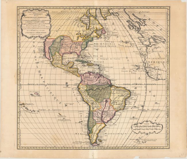
Henrik de Leth was successor to the Visscher firm and a skilled engraver as well as a mapseller and publisher. This map is from his last atlas and depicts the 'New Continent' in geographic and political detail. It describes climates, boundaries, colonial possessions, native people, religions and languages. In North America, the British colonies are confined to the eastern seaboard, and Floride ou Louisiane encompasses the majority of southern and central US. The northwestern portion of North America is left blank and marked as Mer Glaciale. In South America, the mythical lake Xarayes is prominently depicted near the center of the continent. The map is on Mercator's Equal-Area Projection, adding the graphic punch of the distorted longitudinal lines for a very handsome and dynamic appearance. Island groups are named and labeled with dates of their discovery. A rare map.
References:
Condition: B+
Original color with several small centerfold separations that have been mostly closed on verso with archival tissue. An edge tear at top right that extends 1.5" into the image has been closed on verso with archival tape. There is some occasional light staining in the image and a few minor edge chips confined to the blank margins.