Subject: References
Period: 1942 (published)
Publication:
Color: Printed Color
Size:
10.1 x 14.9 inches
25.7 x 37.8 cm
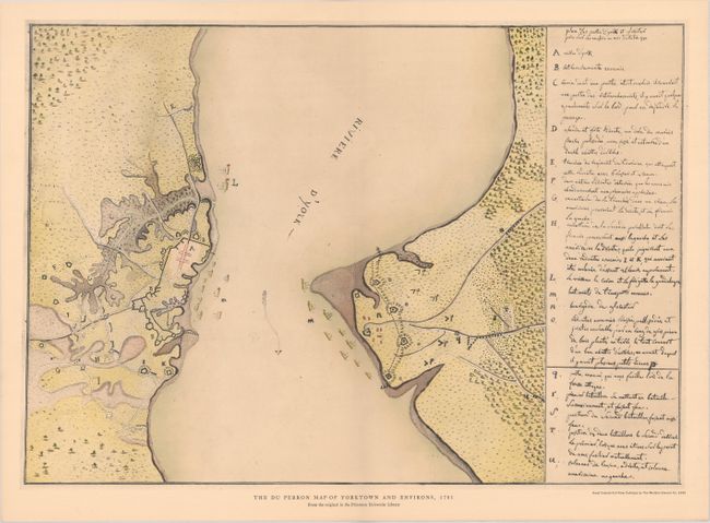
This fascinating facsimile map (17.4 x 12.3") documents the British posts occupied by General Cornwallis at Yorktown and Gloucester. Its cartographer is Joachim du Perron, a French infantryman who participated in the Siege of Yorktown aboard the Languedoc. From his vantage aboard the ship, he was able to observe both the land and naval operations during the battle. The facsimile map is drawn from du Perron's original manuscript, rather than the mediocre copies that appeared in his posthumously published journals. The map is an insert in a 9-page monograph with acknowledgments from Princeton's librarian, Julian A. Boyd, and brief essays by Gilbert Chinard, Robert G. Alison, and Lloyd A. Brown. One of 500 copies, one of 250 with the imprint of the American Friends of Lafayette. Green paper covers.
References:
Condition: B+
The map is in very good condition with minor toning and a hint of offsetting. The monograph is toned with some light scattered foxing. Covers are lightly foxed with some short edge tears and soiling.